
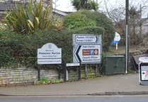
THREE new through-traffic restriction trials will be introduced in the Lower Lansdown area of Bath as part of the council’s Liveable Neighbourhoods programme.
Linked trials in Gay Street, Catharine Place, and Winifred’s Lane, aimed at reducing through-traffic in the Lower Lansdown area, will begin on November 1 and be monitored for at least six months under an Experimental Traffic Regulation Order (ETRO).
People are encouraged to take part in the ETRO consultation and share their views during the first six months of the trial at www.bathnes.gov.uk/lansdownetro.
No decision will be made on the future of the trials until the council has considered all the outcomes and collected data on traffic volumes and air quality.


The trials are the result of ongoing community engagement since 2021, and the decision to install them, along with a detailed description of each trial, is published on the council’s website at www.bathnes.gov.uk/lansdownetro.
Councillor Manda Rigby, cabinet member for highways at Bath & North East Somerset Council, said: “Motorists often use the trial streets to avoid the main roads linking the south of Bath to the A46/A420/M4, so the aim is to address speeding and excessive through traffic in these central, residential areas. We also want to create a safe and pleasant active travel route through the area. I want to reassure residents and businesses that vehicle access to properties will be maintained during the trials, although some drivers may have to use a different route.
“We currently have other Liveable Neighbourhood schemes in place, and these have shown us that the best method of consulting on through-traffic changes is via an ETRO. It gives us time to monitor the impacts of the scheme and for people to respond to the interventions, having experienced the scheme, before we make a final decision on whether to make them permanent.”
The dates for installing the through-traffic restrictions, subject to weather conditions, are:
- Catharine Place Through-Traffic Restriction: Friday November 1
- Gay Street Traffic Restrictions: Mon November 4 & Tues November 5
- Winifred’s Lane Through-Traffic Restriction and a no-right-turn into Sion Hill (East) from the top of Cavendish Road: Wednesday November 6
Full details of the installation programme have been set out in a letter to all residents and businesses in the area and can be found on the Liveable Neighbourhood webpages https://beta.bathnes.gov.uk/lansdownetro
The trials were due to start in August but were put on hold to address a procedural error in legal notices which have now been fixed. The new Experimental Traffic Regulation Order (ETRO) notices will be published on 24 October, and a copy together with a map and a statement of reasons, may be inspected at B&NES’ One Stop Shops at The Hollies, Midsomer Norton, 3-4 Manvers Street, Bath and at the Keynsham Civic Centre, Market Walk, Keynsham during normal office hours.
They can also be viewed online at www.bathnes.gov.uk/lansdownetro
The Liveable Neighbourhoods Programme is funded through the Government’s City Regional Sustainable Transport Settlement (CRSTS) scheme. The West of England Mayoral Combined Authority is responsible for distributing the UK Government’s City Regional Sustainable Transport Settlement (CRSTS) funds to viable schemes in the region.
Its members, including the West of England Mayor and leaders from the Mayoral Combined Authority’s three constituent councils: Bath & North East Somerset Council, Bristol City Council and South Gloucestershire Council.