
Can you identify the location in this week's Mystery Photograph?
The image proved to be a bit of a challenge for some, with only a few correct answers submitted.
Last week’s photo was in fact, Clutton Post Office.
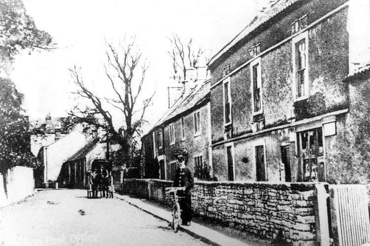

One reader who wrote in with the correct answer was Paul Hancock, who said: “I’m thinking that’s the old post office at Clutton on the Bristol Road.”
And he would be absolutely right!
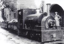
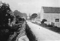
The parish of Clutton was mentioned in the Domesday Book as Clutone, which means "a rocky hill enclosure". The manor of Clutton was given to the Bishop of Coutances by William the Conqueror. The parish church of St. Augustine of Hippo dates from around 1190, but has had several major restorations. The village has a long history of coal mining, but the mines are no longer in operation.
Highbury Hill is home to the earthwork remains of an Iron Age univallate hillfort, designated as a Scheduled Ancient Monument. The hillfort is situated on a 7.5-acre site at the southeastern end of a narrow ridge, surrounded by steep slopes. The fortifications include an outer bank measuring 1.5 feet high and 26 feet long, with a shallow ditch also 26 feet wide. In the late 18th century, Roman silver coins were discovered at the site, adding to its historical significance.
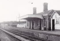
The mines around Clutton were owned by the Earl of Warwick, who also owned sawmills, quarries, brickworks and agricultural interests. The Earl and his wife, Daisy Greville took a keen interest in the welfare of their miners and built Maynard Terrace a unique row of terraced houses at the edge of the village. The village formerly had a station on the Bristol and North Somerset Railway.
Congratulations to all who identified Clutton correctly, best of luck with this week’s Mystery Photograph challenge. We look forward to seeing your guesses and appreciate your continued participation.
Comments
This article has no comments yet. Be the first to leave a comment.